About APEKS
APEKS (Shanghai Apekstool) is a leading provider of advanced geospatial surveying and mapping solutions. With customers in 60+ countries and over 41,500 active users, we deliver reliable GNSS/GPS systems, total stations, levels, and complete Ready-To-Survey packages.
Location
Unit No. 821, 8th Floor,
Jaina Tower-1, District Centre,
Janakpuri, New Delhi - 110058
India
Follow Us
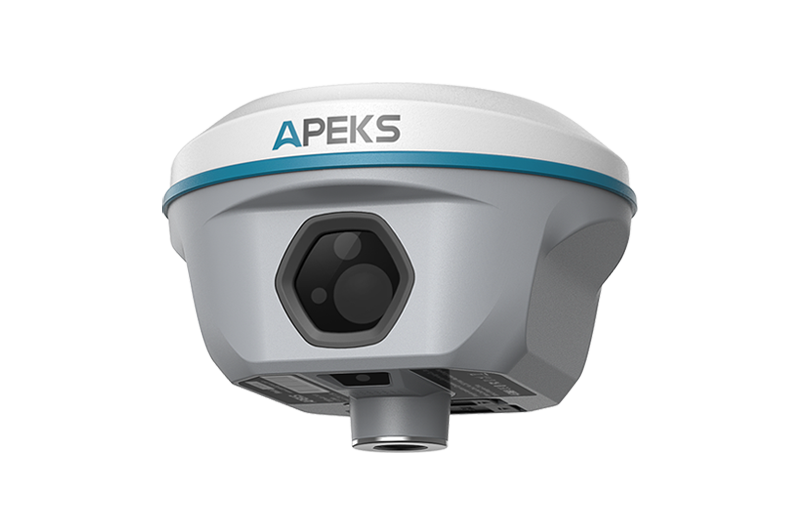
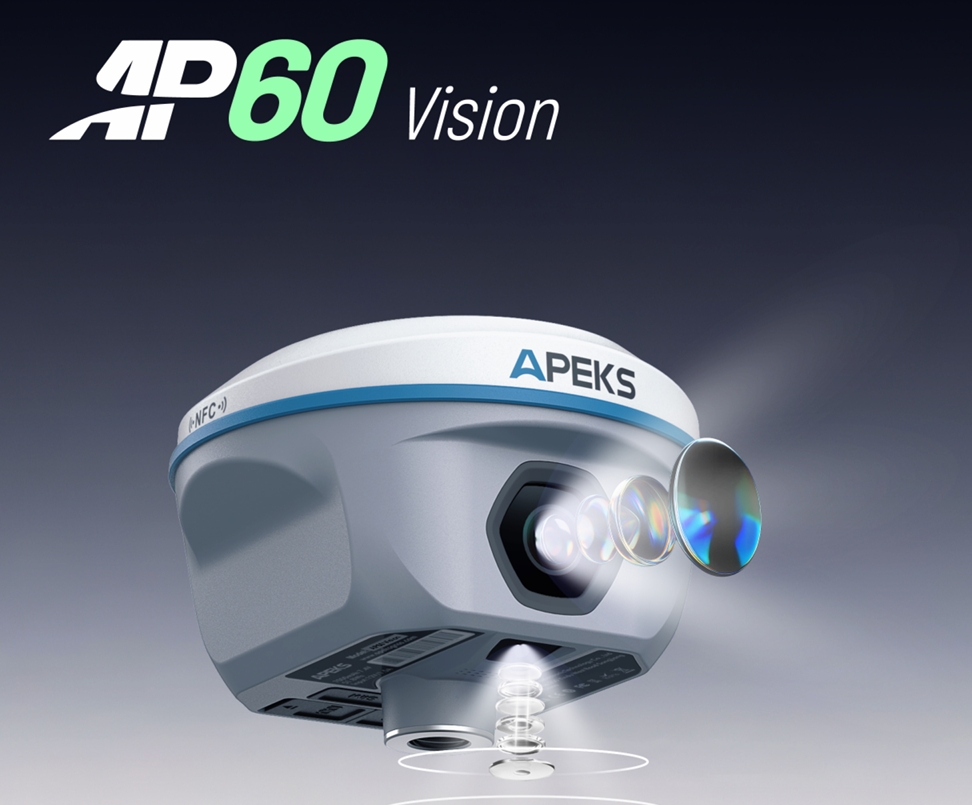
AP60 Vision GNSS Receiver

Where Vision Meets Centimeter Accuracy
Brand
Apeks GNSSDistributor
Trivision Tech (India)Technology
1408-Channel GNSS + Dual Cameras + 120° IMU + 2W UHF + OLEDOverview
The Apeks AP60 Vision is the world’s first truly visual RTK receiver that combines 1408-channel GNSS, high-precision IMU, and dual global-shutter cameras (front + bottom) to enable real-time AR stakeout, visual surveying, and 3D photogrammetric modeling directly in the field. With a bright 0.96" OLED color screen, built-in 2W UHF radio, and up to 120° tilt compensation, the AP60 Vision redefines surveying efficiency in challenging environments.
Key Product Features
- Dual global-shutter cameras – 5MP front + 2MP bottom for AR & photogrammetry
- Real-time AR Stakeout – See exact point location overlaid on live video
- Visual Surveying – Capture 3D coordinates of inaccessible points instantly
- 3D Modeling – Export directly to ContertCapture, Agisoft, or 3D software
- 1408-channel GNSS – Full constellation & multi-frequency support
- Up to 120° tilt IMU – Auto calibration, <5s initialization
- 0.96" high-brightness OLED color screen + dual physical LED buttons
- Built-in 2W UHF TX/RX radio – 8–15 km working range
- 7000mAh battery – 18+ hours RTK, 20+ hours static
- IP67 + 2m pole-drop resistance, -45°C to +75°C operation
- ApeksSurv software with full CAD/DXF import & Web UI management
What We Provide
 Apeks AP60 Vision GNSS Receiver
- Carbon Fiber Survey Pole (optional)
- CS5i / CS3i Data Controller with ApeksSurv Software (optional bundle)
- Full India Warranty & Local Support by Trivision Tech
- Free Technical Support, Firmware & Software Updates
Perfect For
Construction staking in dense areas, topographic surveys under canopies, utility mapping in urban environments, cadastral surveying, 3D modeling of buildings & infrastructure, hazardous-area measurements, archaeology, and any task where visual guidance and inaccessible point capture dramatically improve speed and safety.
Solution & Results
The AP60 Vision eliminates guesswork with live augmented reality stakeout and visual point capture — surveyors can now see exactly where to stake or measure, even under trees, overpasses, or near power lines. Combined with 120° tilt compensation and powerful built-in radio, it cuts field time by up to 70% while delivering full centimeter accuracy and instant 3D deliverables. This is the future of visual, intuitive, high-precision surveying.