About APEKS
APEKS (Shanghai Apekstool) is a leading provider of advanced geospatial surveying and mapping solutions. With customers in 60+ countries and over 41,500 active users, we deliver reliable GNSS/GPS systems, total stations, levels, and complete Ready-To-Survey packages.
Location
Unit No. 821, 8th Floor,
Jaina Tower-1, District Centre,
Janakpuri, New Delhi - 110058
India
Follow Us
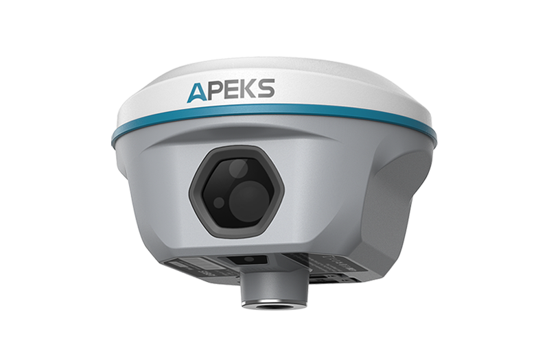
AP30 Laser GNSS Receiver

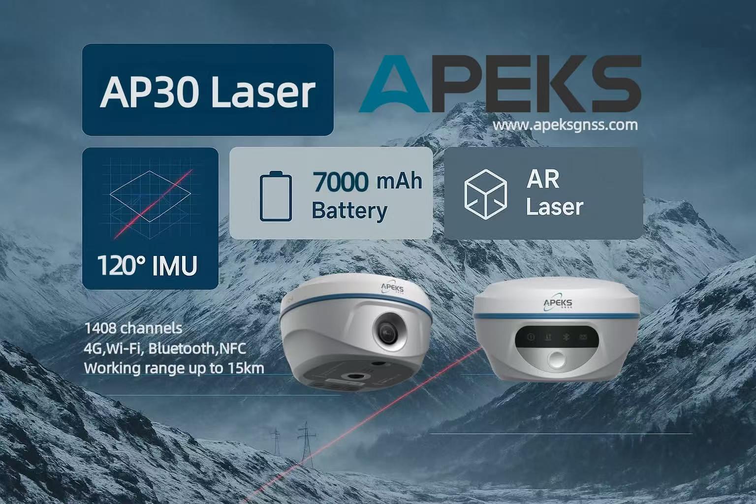
Where the Laser Points – The Point is There
Brand
Apeks GNSSDistributor
Trivision Tech (India)Technology
1408-Ch GNSS + 120° IMU + 3.0 Green Laser + Front Camera AROverview
The AP30 Laser is a revolutionary high-end GNSS receiver that integrates the latest 1408-channel GNSS board, ultra-accurate IMU, millimeter-level green laser pointer, and front-facing camera for real-time AR stakeout. The visible 3.0 green laser allows instant point marking up to 10 meters away — simply point and shoot. Combined with up to 120° tilt compensation and immersive AR stakeout via the front camera, the AP30 Laser makes complex surveys easier, faster, and smarter.
Key Product Features
- Visible 3.0 Green Laser – Point & mark up to 10m
- Front camera with real-time immersive AR stakeout
- Up to 120° IMU tilt compensation (<2cm accuracy within 60°)
- 1408 channels – Full constellation & multi-frequency
- Built-in 2W UHF Tx/Rx radio – Up to 15km working range
- 9000 mAh battery – Full-day operation
- IP67 rugged magnesium alloy body
- Web UI management + WiFi firmware upgrade
What We Provide
 AP30 Laser GNSS Receiver
- CS3i Android 11 Rugged Data Controller
- ApekSurv Professional Field Software (Android)
- Full India Warranty & Local Support by Trivision Tech
- Carbon Fiber Pole, Charger, UHF Antenna & Accessories
- Web UI Management & Cloud Firmware Updates
Data Controller – CS3i
Android 11 rugged handheld | 5.5" sunlight-readable screen | IP68 dust & waterproof | 9000 mAh battery | 4G + WiFi + Bluetooth | Physical keypad | Pre-loaded with full ApekSurv software.
ApekSurv Field Software
Complete surveying suite supporting CAD/DXF direct import, AR stakeout, multiple base maps (Google, WMS), coordinate systems, RTK, PPK, and seamless export in all major formats (DXF, SHP, KML, CSV, etc.).
Solution & Results
The AP30 Laser redefines precision surveying by combining centimeter-level RTK accuracy with a visible green laser pointer and immersive AR navigation. Surveyors can now mark points instantly without bending down, even in hard-to-reach or obstructed locations. The front camera enables real-time visual stakeout — simply follow the on-screen arrows. Ideal for cadastral surveys, construction layout, topographic mapping, and high-precision GIS work. Reduces field time by up to 50% and eliminates human error in complex environments.